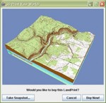
 A while ago we introduced Landprint, a very interesting service that permits anyone to print a 3D model of a selected landscape.
Using the service, you can print out a 3D map of your favorite vacation spot or neighborhood.
Now we find the service discovered by the Geo-community in the form of EarthIsSquare, a site dedicated to all things geo, where they try out the service to produce a 3D map of the Pennsylvania Grand Canyon.
Via EarthIsSquare

