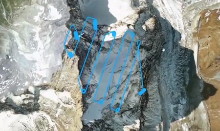
 A new approach to capturing 3D scans of extremely large objects has been pioneered by senseFly, who produce the eBee drone series. They teamed with Drone Adventures, an organization dedicated to demonstrating the power of drones, to capture a detailed scan of the Matterhorn, Europe’s tallest mountain.
 A team scaled the mountain and then released eBee drones that followed specific flight paths designed on the fly by the drones themselves (see image above). As you might imagine, the drones could not fly up the mountain on their own, so they had to be launched by hand at mountaintop. To finalize the capture, the drones required only:
- 11 flights
- 5:40 flight time
- 2188 images
- 263.6km flown
Once a model is captured, it of course can be 3D printed – if the 3D model file is released. In this case, we don’t think so.
Nevertheless, this technology could obviously be used to capture detailed scans of any large structure, including not only natural features, but buildings, bridges, homes and anything else that’s outside.
If you hear a buzzing noise, smile.
Via IEEE Spectrum

